There are not many weather stations in Alaska that have continuous, long term snow measurements. Fairbanks, Anchorage, Bettles, and Juneau have the longest and most consistent records of snow fall and snow depth and are great for comparing current snow levels to the climatological normal. February was quite snowy at all four stations: Bettles received 117% of normal and Fairbanks, Anchorage, and Juneau all got more than twice their normal amount of monthly snowfall. Juneau was snowiest in relative terms with an impressive 278% of normal for February.
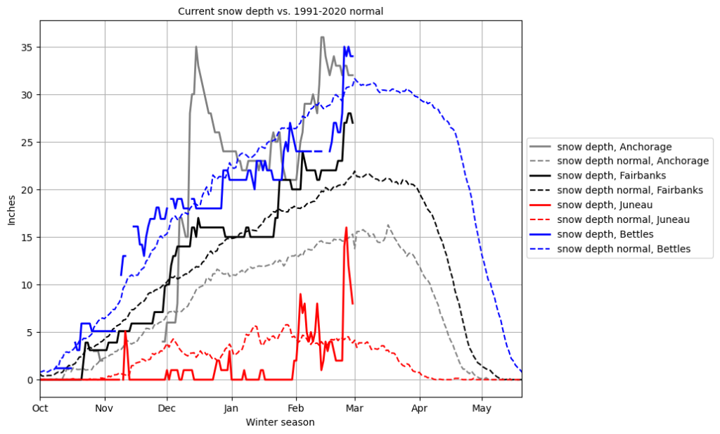
Snow depth is also above average at all four stations. Anchorage in particular has a deep snow pack this year, thanks to the December snow falls (see previous blog post) and renewed accumulation throughout February. Juneau did not have a snow pack to speak of until the beginning of February due to warm temperatures during precipitation events – the winter season wasn’t particularly dry, but too warm for snow fall to accumulate at Juneau airport. In February, colder precipitation finally arrived and the Juneau snow pack increased to above average values. Snow fall during the last week of the month caused the Urban Avalanche Advisory to raise the danger level to High (level 4 of 5) for Juneau and the storm situation is ongoing as of March 2. Avalanches can become large or even very large due to the combination of new snow and wind loading at higher elevations. Travel in avalanche terrain is dangerous and not recommended under these conditions. Warnings were issued for certain urban trails that cross avalanche terrain.
Snow depth through Feb. 28, 2023, for Anchorage, Fairbanks, Juneau, and Bettles compared to the 1991-2020 climatological mean. Data: RCC ACIS
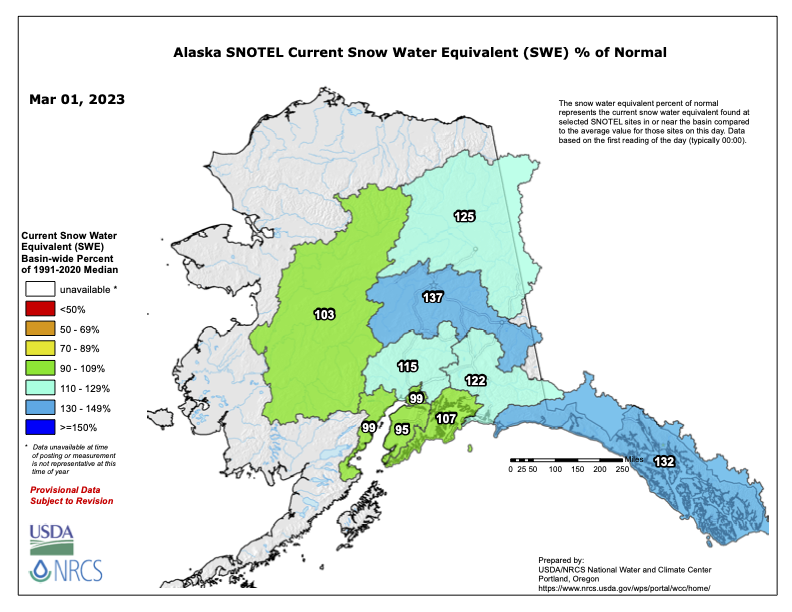
Fairbanks and Bettles both have moderately above average snow depth as of March 1st. Based on the current report from the SNOTEL station network, snow water equivalent (SWE) is roughly at normal levels in South Central and the western Interior and moderately above average across the Panhandle and the Tanana basin.
SWE as of March 1 from SNOTEL network. Data and plot: USDA, NRCS
We use cookies to ensure that we give you the best experience on our website. If you continue to use this site we will assume that you are happy with it.AcceptPrivacy policy